

Author: Space Economy Academy
Difference Between GPS and GNSS Explained
The difference between GPS and GNSS is essential to understand modern satellite navigation systems. Although many people use both terms interchangeably, they do not mean exactly the same thing. GPS refers to a specific navigation system developed by the United States, while GNSS is the broader term that includes multiple satellite constellations working together to provide positioning, navigation and timing services worldwide.
Today, satellite navigation is deeply embedded in everyday life. It supports route guidance in smartphones, aircraft navigation, emergency response, agriculture, maritime operations and many industrial applications. Because of this, understanding the difference between GPS and GNSS is not just a technical detail. It helps explain why modern navigation devices are becoming more accurate, more reliable and more resilient in challenging environments.
Explore the GNSS Systems course at SEAC
What Is GPS?
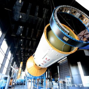
The Global Positioning System, commonly known as GPS, is a satellite navigation system operated by the United States. It was originally developed for military purposes and later opened for civilian use. Over time, GPS became the most recognised navigation system in the world and laid the foundation for many of the location-based services people use today.
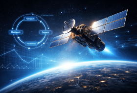
GPS works through a constellation of satellites orbiting Earth. These satellites continuously transmit signals that can be received by devices on the ground. By measuring the travel time of those signals, a receiver can calculate its position, velocity and time with remarkable precision.
Because GPS was the first system to become widely known at a global scale, many people began using “GPS” as a generic term for all satellite navigation. However, this is not entirely correct. GPS is only one system within a much broader global framework.
What Is GNSS?
Global Navigation Satellite System, or GNSS, is the generic term used to describe all satellite-based navigation systems worldwide. In other words, GPS is one member of the GNSS family, but GNSS also includes other constellations developed by different countries and regions.
The main GNSS constellations include GPS from the United States, Galileo from the European Union, GLONASS from Russia, and BeiDou from China. In addition, there are regional systems such as QZSS from Japan and NavIC from India. Modern receivers often combine signals from several of these systems at the same time.
This multi-constellation approach is one of the biggest reasons why GNSS is so powerful. Instead of depending on a single source of positioning data, GNSS receivers can use multiple satellite systems simultaneously. That improves satellite visibility, increases redundancy and enhances accuracy. For a deeper comparison across systems, you can also explore the differences between GNSS constellations.
Main Difference Between GPS and GNSS
The simplest way to explain the difference between GPS and GNSS is this: GPS is one navigation system, while GNSS is the global umbrella term for all of them.
- GPS: a single satellite navigation system operated by the United States.
- GNSS: a broader concept that includes GPS, Galileo, GLONASS, BeiDou and other regional systems.
This distinction matters because modern devices rarely depend only on GPS anymore. Instead, they increasingly rely on GNSS receivers that combine signals from several constellations to achieve better performance.
Why GNSS Is More Accurate Than GPS
One of the biggest advantages of GNSS over GPS is improved accuracy. A GPS-only receiver depends on one constellation, which may work very well in open environments but can struggle when buildings, terrain or other obstacles block satellite visibility.
GNSS receivers improve this situation by using multiple constellations at once. This means more satellites are available in the sky, which improves the geometry of the position calculation. Better geometry generally results in better positioning accuracy.
GNSS also improves reliability in difficult environments such as urban canyons, mountainous terrain, forests and high-latitude regions. If signals from one constellation are weakened or blocked, the receiver can still rely on others. This makes positioning more stable and robust.
- More satellites in view: higher signal availability.
- Better geometry: stronger position calculations.
- Higher redundancy: less dependence on a single system.
- Fewer errors: improved performance in challenging environments.
Which Satellite Systems Are Part of GNSS?
To understand GNSS properly, it helps to know the main constellations included within it:
- GPS: the United States’ global navigation system.
- Galileo: the European Union’s civilian-controlled system with strong accuracy performance.
- GLONASS: Russia’s global navigation system, particularly useful at higher latitudes.
- BeiDou: China’s system, which has evolved from regional to global coverage.
- QZSS: Japan’s regional system, designed to enhance signal availability in urban areas.
- NavIC: India’s regional navigation system, focused on India and surrounding regions.
Together, these systems make GNSS a much broader and more capable framework than GPS alone.
How GPS and GNSS Work Together in Modern Devices
Most modern navigation devices, including smartphones, connected cars, drones and some industrial systems, use GNSS receivers rather than GPS-only receivers. This means they can process signals from multiple constellations simultaneously.
For example, a smartphone user walking through a dense city may benefit from both GPS and Galileo signals, while a vehicle system may also receive GLONASS or BeiDou. This improves route guidance, reduces location dropouts and creates a smoother navigation experience.
In practice, users often still say “GPS” because it is familiar. But the actual technology running behind the scenes is increasingly GNSS.
Applications of GNSS in Daily Life
GNSS plays a role in many sectors far beyond consumer navigation. Its applications are now essential in both everyday life and advanced technological systems.
- Transportation: vehicles rely on GNSS for routing, traffic updates and fleet tracking.
- Aviation: aircraft use satellite navigation for precision routing and safer operations.
- Agriculture: precision farming depends on accurate GNSS positioning for planting and harvesting.
- Emergency services: responders use GNSS to locate people and navigate quickly to incidents.
- Autonomous systems: robots, drones and self-driving technologies depend on satellite positioning.
- Telecommunications and timing: GNSS provides essential timing references for many critical infrastructures.
Future of GNSS and Satellite Navigation
The future of satellite navigation is strongly tied to GNSS evolution. As constellations grow, signals improve and receivers become more advanced, positioning services will continue to become more precise, robust and integrated with other technologies.
Key developments include multi-frequency receivers, tighter integration with inertial navigation systems, and the use of GNSS in autonomous mobility, aviation, logistics, and space operations. This means the difference between GPS and GNSS will become even more important to understand, because future systems will depend more on integrated global constellations than on one standalone system.
Conclusion
Understanding the difference between GPS and GNSS is essential in a world that increasingly relies on satellite-based navigation. GPS is a specific navigation system developed by the United States, while GNSS is the broader framework that includes multiple constellations such as Galileo, GLONASS and BeiDou.
That difference matters because GNSS offers better accuracy, stronger reliability and wider availability by combining several systems into one navigation solution. In practical terms, this means the devices people use every day benefit from a more advanced and resilient infrastructure than GPS alone.
Discover the GNSS Systems course