
GNSS Engineering & Applications (Professional Certificate)
- Space
- 576 (Registered)
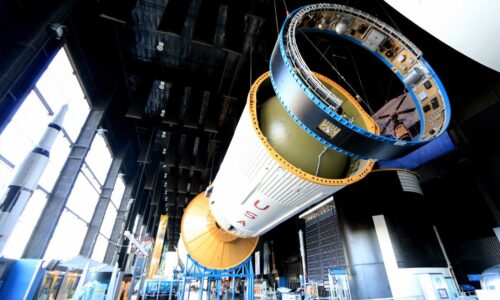
The Next Space Frontier
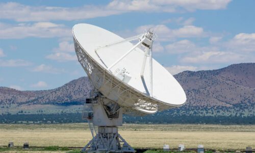
Global Navigation Satellite Systems (GNSS) have revolutionized navigation and positioning, providing accurate location information worldwide. GNSS systems, such as GPS, GLONASS, Galileo, and BeiDou, rely on a constellation of satellites to broadcast signals enabling receivers to determine their precise position. Current trends in GNSS involve increased accuracy, reliability, and accessibility, with advancements like multi-constellation and multi-frequency receivers enhancing performance.
Evolution in GNSS technology includes the deployment of next-generation satellites with improved capabilities and the integration of augmentation systems for enhanced accuracy in challenging environments. Projections indicate continued expansion of GNSS applications across various sectors, including transportation, agriculture, telecommunications, and emergency services, with an estimated market value of over $320 billion by 2025. These advancements promise to further empower industries and individuals with reliable, high-precision positioning capabilities, driving innovation and economic growth.
Overview of the GNSS Advanced Course
SEAC professional online Space GNSS training is a program aiming at providing students with an advanced and comprehensive understanding of satellite navigation technology and its applications. Throughout the course, participants will focus on the principles of satellite navigation, including the functioning of satellite constellations, signal transmission, and receiver operation.
Global Positioning System (GPS) is analysed as the primary satellite navigation system. Additionally, they will explore other systems like Galileo, GLONASS and BeiDou. The students of GNSS will focus on the different types of receivers, design considerations, and signal processing techniques to interpret satellite data accurately. This will be followed by the different augmentation systems (SBAS and GBAS) , as well as error sources when using the systems. Students will also make use of real case studies to interpret satellite data accurately.
In addition, the course prioritizes practical skills by introducing Software-Defined Radio (SDR) through MATLAB, which will serve as the principal tool for GNSS signal processing throughout the course. Students will study limitations in the signal processing chain, which includes jamming, spoofing, and multipath, and explore advanced methodologies such as Precise Point Positioning (PPP), Real-Time Kinematics (RTK), and augmentation systems like SBAS, GBAS and they will further develop the technical expertise and analytical skills required to effectively apply GNSS technology in practical scenarios through case studies and practical exercises, along with identifying common sources of error in GNSS and the impact on accuracy and precision, which will also be discussed in the course.
The skills you will develop
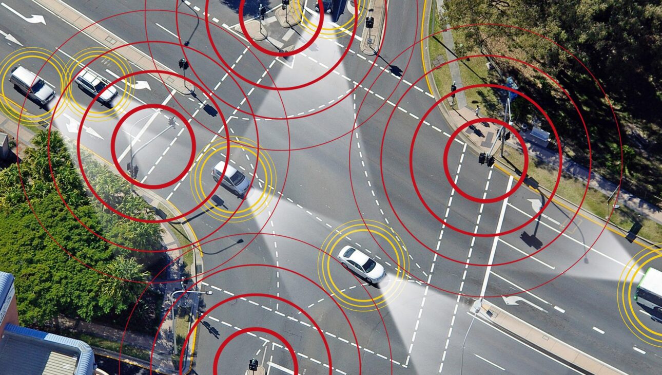
Global Navigation Satellite Systems (GNSS) are a key technology enabling positioning, navigation, and timing services used across multiple industries worldwide. Through this course, participants gain a structured understanding of GNSS principles, system architectures such as GPS and other navigation systems, receiver technologies, and the methods used to improve positioning accuracy and mitigate signal errors.
SEAC – Certificate of Completion
Advance your career in GNSS Systems with SEAC—first-prize winner of the Galileo Masters University Challenge. Incubated at ESA BIC Hessen with leading industry partners, you’ll earn a Certificate of Completion in GNSS advanced.
Companies & Professional Training
SEAC – Space Economy Academy supports companies, space agencies, and institutions in the professional development of their teams through specialized training in the space sector. Our programs combine industry insight with practical knowledge of the global space economy, helping professionals understand the strategic, technological, and commercial dimensions of the industry. Designed for both technical and managerial profiles, SEAC courses enable organizations to strengthen internal expertise, and develop the capabilities required to operate within the international space sector.
Many organizations choose to enroll several participants in the same program in order to develop shared expertise across their teams and strengthen internal capabilities. Companies enrolling groups of 3 or more participants benefit from exclusive corporate discounts, facilitating the training of multiple team members within the same program. In addition to open-enrolment courses, SEAC can also deliver tailor-made training programs for companies, providing turnkey solutions aligned with specific organizational needs and training objectives.
GNSS Advanced Programme Questions
Key information about the programme format, certificate, tutor feedback, GNSS applications, and brochure download.
How is the GNSS Advanced course delivered?
The GNSS Advanced programme is delivered through a flexible online learning format designed for professionals and organizations operating in the space, navigation, and aerospace sectors. Participants can access the educational platform according to their own schedule while progressing through technical modules and practical assignments.
Will I receive a professional certificate?
Yes. Participants who successfully complete the programme receive a professional Certificate of Completion issued by SEAC – Space Economy Academy, incubated at ESA BIC Hessen and awarded by the Galileo Masters competition.
Will I interact with lecturers or tutors during the programme?
Yes. Participants complete assignments during the programme and receive individual feedback from tutors and industry professionals. SEAC also organizes selected webinars, alumni events, and industry sessions throughout the year.
Is the programme suitable for working professionals?
Absolutely. The programme was specifically designed for professionals who need flexibility alongside their work responsibilities. Participants can progress through the content at their own pace while maintaining full access to the educational platform and future course updates.
How can the GNSS Advanced course support professionals and companies?
The programme provides a structured understanding of satellite navigation systems, GNSS signal processing, positioning methods, augmentation systems, and receiver technologies. It is particularly valuable for engineers, analysts, aerospace professionals, and organizations seeking expertise in navigation technologies, precision positioning, and satellite-based applications.
Where can I download the programme brochure?
The official programme brochure includes detailed information about the curriculum, lecturers, assignments, certificate, learning outcomes, and course structure.
Curriculum
- 11 Sections
- 52 Lessons
- Lifetime
- Global Navigation Satellite SystemsGlobal Navigation Satellite Systems2
- The Radio-Navigation Concept4
- GNSS, All Global Navigation Systems7
- 3.13.1. GNSS System Segments
- 3.23.2. Global Positioning System – GPS
- 3.33.3. European Global Navigation Satellite System – Galilleo
- 3.43.4. Other Satellite Navigation Systems (Glonass, Beidou..)
- 3.5Reading: Analysis on coverage ability of BeiDou navigation satellite system for manned spacecraft
- 3.63.5. GNSS Systems Comparison
- 3.7Reading: Battles in space: De-facto standardization of Global Navigation Satellite Systems
- Fundamentals of GNSS ReceiversFundamentals of GNSS receivers8
- 4.14.1. Receiver Architecture
- 4.24.2. Acquisition
- 4.34.3. Tracking
- 4.4Reading: Monitoring the dynamic response of a pedestrian bridge by using low-cost GNSS receivers
- 4.54.4. Navigation Unit
- 4.64.5. Interference, Multipath, and Scintillation
- 4.7Reading: Investigation of the impact of Ionospheric Scintillation on GNSS Performance over East Africa
- 4.84.6. Use cases and associated level of performance
- Introduction of the Major Augmentation SystemsIntroduction of the major Augmentation Systems5
- Advanced GNSS Signal Foundations6.1 Understanding GNSS and Signal Structure4
- Advanced GNSS Acquisition & Tracking6
- Advanced GNSS Interference & Resilience3
- MATLAB + SKYDEL4
- Advanced GNSS SDR Techniques6
- Advanced GNSS PPP/RTK Solutions3
Lecturer
Related Courses