
BeiDou Navigation System: China GNSS and the Future of Satellite Navigation
Author: Marcel Weber
The BeiDou Navigation System is China’s global navigation satellite system and one of the most important infrastructures in the modern GNSS ecosystem. Alongside GPS, Galileo and GLONASS, BeiDou provides positioning, navigation and timing services for transportation, logistics, agriculture, smart cities, emergency response, maritime operations and autonomous systems.
However, BeiDou is much more than a constellation of navigation satellites. It is a strategic digital infrastructure that connects satellite technology with commercial applications, industrial development, location-based services and the wider China commercial space industry.
For professionals interested in the future of the global space economy, BeiDou offers a powerful example of how GNSS infrastructure can become a platform for business growth, downstream innovation and space-enabled services.
Key Insight: BeiDou is not only a satellite navigation system. It is a major pillar of China’s space infrastructure, supporting GNSS services, smart mobility, logistics, precision agriculture, industrial automation and commercial space applications.
What Is the BeiDou Navigation System?
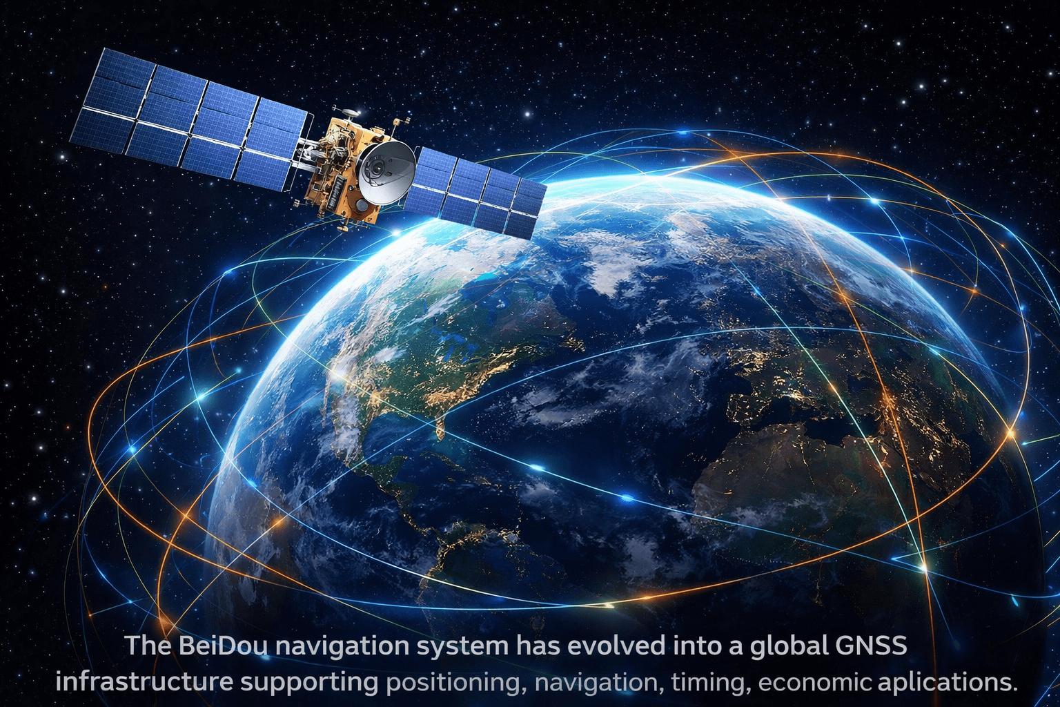
The BeiDou Navigation System, also known as BDS or BeiDou GNSS, is China’s satellite navigation constellation. It provides global positioning, navigation and timing services to users around the world.
Like other global navigation satellite systems, BeiDou allows receivers on Earth to calculate their position by using signals transmitted from satellites in orbit. These services are essential for smartphones, vehicles, aircraft, ships, industrial equipment, financial networks, telecom infrastructure and scientific applications.
What makes BeiDou especially relevant is its role in the broader Chinese satellite infrastructure. It is not only a technical system, but also a commercial platform that supports hardware manufacturers, chipmakers, data services, software providers and downstream applications.
This is why BeiDou is closely connected to the future of the China space economy, where satellites, data, navigation, AI and commercial services are becoming increasingly interconnected.
Why BeiDou Matters for China’s Space Economy
BeiDou matters because GNSS is one of the clearest examples of how space infrastructure creates economic value on Earth. Rockets and satellites are important, but the largest long-term value often comes from the services enabled by space systems.
Satellite navigation supports daily activities across many industries. Logistics companies use GNSS for fleet tracking. Farmers use precise positioning for automated machinery. Cities use location data for traffic management. Telecom networks depend on accurate timing. Emergency services rely on positioning to coordinate response operations.
For China, BeiDou strengthens the country’s ability to build domestic supply chains, support digital infrastructure and create commercial services around navigation and timing. This makes BeiDou a key component of China’s broader commercial space strategy.
In that sense, BeiDou is not isolated from the New Space economy. It is one of the foundational systems that allows the Chinese commercial space ecosystem to expand into practical business applications.
Master GNSS Systems and Satellite Navigation
BeiDou shows why GNSS knowledge is becoming essential for engineers, analysts, entrepreneurs and professionals working in the space sector.
SEAC’s GNSS Systems Course provides practical knowledge about satellite navigation, GNSS constellations, signals, positioning methods and real-world applications.
Explore the GNSS Systems CourseDevelopment of BeiDou: From Regional Service to Global GNSS
The development of the BeiDou Navigation System followed a phased approach. This gradual strategy allowed China to move from an initial regional capability to a complete global satellite navigation infrastructure.
BDS-1: The First Chinese Navigation Capability
The first phase, known as BDS-1, provided early navigation and communication-related services mainly for China. It demonstrated the feasibility of an independent Chinese satellite navigation system and created the foundation for later expansion.
BDS-2: Regional Expansion Across Asia-Pacific
BDS-2 expanded the system across the Asia-Pacific region. This stage increased satellite coverage and made BeiDou more useful for transportation, maritime operations, logistics, infrastructure and public services.
BDS-3: Global BeiDou Navigation System
BDS-3 transformed BeiDou into a global GNSS system. With worldwide service capability, BeiDou became part of the broader multi-GNSS environment, enabling users to combine BeiDou signals with GPS, Galileo and GLONASS.
This evolution is important from a market perspective. It shows how a national satellite infrastructure can become a global platform for commercial applications, industrial services and international GNSS adoption.
Core Services of the BeiDou Navigation System
The BeiDou Navigation System provides several services that make it valuable for both consumer and professional users. Its core function is positioning, navigation and timing, but its service architecture also supports additional capabilities.
- Positioning: location services for smartphones, vehicles, ships, aircraft and industrial assets.
- Navigation: route guidance for transportation, logistics, maritime operations and autonomous platforms.
- Timing: synchronization for telecom networks, financial systems, energy grids and critical infrastructure.
- Short message communication: communication support in selected operational scenarios.
- Search and rescue: satellite-based support for emergency response and safety services.
- High-precision positioning: improved accuracy for agriculture, construction, surveying and industrial automation.
These services make BeiDou commercially relevant because they support real-world sectors where accurate positioning and timing directly improve efficiency, safety and automation.
Market Trend: The biggest commercial opportunity in GNSS is not only satellite deployment. It is the downstream market created by receivers, chipsets, positioning software, smart mobility platforms, logistics systems and high-precision services.
Commercial Applications of BeiDou in China
The commercial value of BeiDou becomes clear when looking at its applications across the Chinese economy. Satellite navigation supports many sectors that depend on movement, timing, automation and real-time data.
Logistics and Fleet Management
Logistics companies can use BeiDou for vehicle tracking, route optimization, cargo monitoring and fleet safety. In large transport networks, accurate satellite positioning can reduce inefficiencies and improve operational control.
Smart Cities and Urban Mobility
BeiDou can support smart traffic systems, ride-hailing services, bike-sharing networks, public transportation, parking systems and emergency response. As cities become more connected, GNSS becomes a key layer of urban digital infrastructure.
Precision Agriculture
Agriculture is one of the most important high-precision GNSS markets. BeiDou can support automated tractors, drone mapping, field monitoring, variable-rate application and resource optimization.
Autonomous Vehicles and Robotics
Autonomous vehicles and robots require positioning, timing and sensor fusion. BeiDou can contribute to navigation for self-driving vehicles, industrial robots, mining equipment, port automation and unmanned aerial systems.
Maritime and Emergency Services
Maritime navigation, fishing fleets, port logistics, offshore platforms and search-and-rescue operations all depend on reliable satellite positioning. BeiDou adds another layer of resilience to these critical services.
BeiDou, Multi-GNSS and Global Satellite Navigation
Modern GNSS receivers increasingly use several constellations at the same time. Instead of relying on only one system, many devices combine GPS, Galileo, GLONASS and BeiDou signals to improve availability and accuracy.
This multi-GNSS approach is especially useful in difficult environments such as dense cities, mountainous regions, ports, forests and industrial areas. More satellites generally mean better signal geometry, stronger redundancy and improved positioning continuity.
BeiDou therefore matters globally because it strengthens the overall GNSS ecosystem. For users and companies, the rise of BeiDou means more options, more resilience and more opportunities to build location-based services.
To understand how BeiDou compares with other navigation systems, explore this SEAC article on the differences between GNSS systems.
How BeiDou Supports China’s Commercial Space Industry
BeiDou is one of the strongest examples of how satellite infrastructure supports a larger space economy. Around BeiDou, companies can develop GNSS receivers, antennas, chips, positioning software, fleet platforms, geospatial services and industrial applications.
This creates a complete value chain connecting space assets with ground infrastructure and end-user markets. It also shows why the China commercial space industry should not be understood only through launch companies or satellite manufacturers.
The real value of space infrastructure appears when satellites enable commercial activity on Earth. BeiDou supports this transition by turning orbital navigation services into economic tools for mobility, logistics, agriculture, energy, telecommunications and public infrastructure.
For a wider view of China’s satellite, launch and space business ecosystem, read our cornerstone article: China Commercial Space Industry: The Future of the Global Space Economy.
Build Expertise in GNSS and the Global Space Economy
BeiDou connects two essential areas of the space sector: satellite navigation and commercial space markets. Professionals who understand both will be better prepared for future opportunities.
SEAC offers specialized courses designed for engineers, analysts, entrepreneurs and professionals entering the satellite navigation and commercial space sectors.
The Future of BeiDou and GNSS Market Growth
The future of BeiDou will likely be shaped by higher precision, stronger resilience, integration with communications networks, autonomous mobility, artificial intelligence and geospatial analytics.
As industries become more dependent on digital infrastructure, GNSS will become even more important. Logistics, construction, banking, agriculture, telecommunications, energy and mobility all depend on precise positioning or timing in different ways.
This creates business opportunities for companies working in satellite navigation, receiver manufacturing, GNSS software, high-precision services, geospatial data and space-enabled digital platforms.
For China, BeiDou is both a technological infrastructure and a commercial growth engine. It strengthens the country’s role in GNSS while supporting the broader development of satellite applications and the future space economy.
Conclusion
The BeiDou Navigation System has evolved into one of the most important GNSS infrastructures in the world. It provides positioning, navigation and timing services while supporting smart mobility, logistics, agriculture, telecommunications, emergency services and industrial automation.
Its importance goes beyond navigation. BeiDou is a major pillar of China’s satellite infrastructure and a key enabler of commercial space applications. It demonstrates how GNSS systems can become platforms for downstream markets, digital services and industrial innovation.
As the global space economy continues to expand, BeiDou will remain central to understanding China GNSS, satellite positioning, commercial space infrastructure and the future of space-enabled business.
Frequently Asked Questions About BeiDou Navigation System and China GNSS
Is BeiDou a global navigation satellite system?
Yes. BeiDou is China’s global navigation satellite system, providing positioning, navigation and timing services to users worldwide. It operates alongside GPS, Galileo and GLONASS, strengthening the multi-GNSS environment used by smartphones, vehicles, industrial receivers and professional positioning systems.
How does BeiDou support China’s smart city development?
BeiDou supports smart cities by enabling accurate positioning for traffic control, public transport, shared mobility, infrastructure monitoring and emergency response. When combined with sensors, maps and urban data platforms, BeiDou helps cities improve efficiency, safety and real-time management of public services.
Why is BeiDou important for logistics in China?
BeiDou is important for logistics because it enables vehicle tracking, route optimization, cargo monitoring and fleet management. These capabilities are valuable for trucks, ports, rail networks and delivery platforms, especially in large markets where transport efficiency directly affects productivity and cost control.
Can BeiDou be used together with GPS and Galileo?
Yes. Many modern GNSS receivers can use BeiDou together with GPS, Galileo and GLONASS. This multi-constellation approach improves satellite availability, positioning continuity and signal geometry, especially in challenging environments such as dense cities, mountains, ports and industrial areas.
What industries benefit most from BeiDou applications?
The industries that benefit most from BeiDou include transportation, agriculture, maritime operations, telecommunications, construction, mining, emergency response and autonomous mobility. These sectors use satellite positioning and timing to improve safety, automation, asset tracking, resource management and operational efficiency.
How does BeiDou contribute to China’s satellite infrastructure?
BeiDou contributes to China’s satellite infrastructure by providing a national and global positioning backbone. It connects satellites, ground systems, receivers, chipsets, software platforms and digital services, creating a complete ecosystem around navigation, timing and location-based applications.
Is BeiDou relevant for autonomous vehicles?
BeiDou is relevant for autonomous vehicles because accurate positioning is essential for navigation, sensor fusion and route planning. Although autonomy also depends on cameras, lidar, radar and software, GNSS systems such as BeiDou provide an important positioning reference layer.
What is the commercial value of BeiDou?
The commercial value of BeiDou comes from downstream applications rather than satellites alone. Companies can build services around fleet management, precision agriculture, geospatial analytics, smart mobility, timing infrastructure, receiver manufacturing and high-precision positioning for industrial markets.
How does BeiDou strengthen the China space economy?
BeiDou strengthens the China space economy by turning satellite navigation into a platform for services, devices and industrial applications. It supports domestic supply chains, commercial GNSS products, digital infrastructure and space-enabled markets linked to mobility, logistics, agriculture and smart cities.
What is the future of BeiDou navigation services?
The future of BeiDou navigation services will likely include higher precision, stronger resilience, deeper integration with communications networks and expanded use in autonomous systems. Its growth will be closely linked to smart infrastructure, commercial GNSS markets and China’s broader space economy.


